


Nego
Rp95.000.000,-
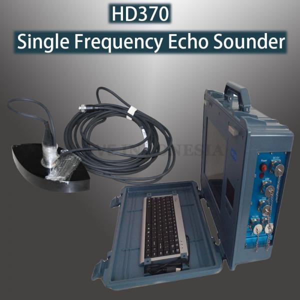
Hi Target Echo Sounder Single Frequency HD-370
View: 325
Category: Electronic Others
Category: Electronic Others
About This Ad
Price: Rp95.000.000,-
Negotiable
Type: Sale
Condition: New
Ads Description:
Onboard Software
Hi-Target professional three-in-one functions hydrographic software includes depth sounding & positioning as well as post processing functions. With user-friendly interface, integrated sound velocity correction, auto gain control, adjustment for transmission power/pulse width/signal gate etc. features, it is ready to make you transit from traditional thermal paper records experience to all digital data acquisition systems with paperless and user-friendly.
1. Automatic measurement operation design, it always ready for measuring when power on if you pre-setting up the parameters. Depth data value is intuitively displayed by graphic, Echogram is saved in digital encrypted files, convenient for long-term storage, replay, inquiry and print your valuable data.
2. With abundant coordinates system in the data library, it is available for you to select the suitable local coordinate system in your country, and you can create a new coordinate system and save it in the coordinate system library easily. The coordinate system resource files are fully interchangeable for all other software from Hi-Target, such as Hi-RTK software, H-Target Geomatics Office software etc.
3. Flexible to import other DXF format charts and data, it will be more convenient for users to edit the designed professional tracking chart in advance in AutoCAD and then import the tracking chart to the echo sounder software.
4. With easy-to-use operation post-processing software, which the process is very convenient (you just need to operate the software according to the left items from top to bottom). It will definitely provide you a confident accurate solution after main core technology post processing.
Applications
Ideal for fairway, coastland depth measurement; reservoir, river, lake, freshwater depth measurement; dredging engineering measurement, ocean surveying, and marine construction engineering surveying.